
A valley between two ranges
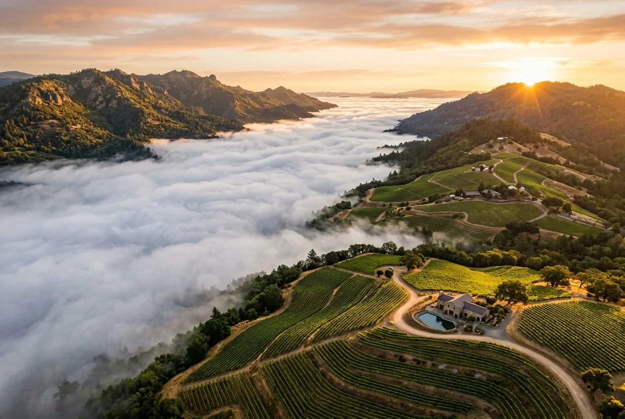
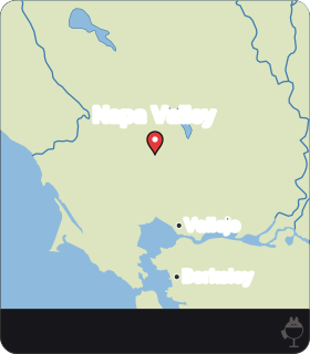
The Napa Valley lies between two mountain ranges: the Mayacamas Mountains, part of the northern Coast Ranges, on the west, and the Vaca Mountains on the east. This article compares two kinds of vineyard land inside that frame: the flat valley floor and the slopes that rise into each range.
The wider frame is tectonic. The Coast Ranges run roughly parallel to the San Andreas Fault, a transform boundary along which the Pacific Plate moves north relative to the North American Plate. East of the Vaca Mountains lies the Central Valley, also called the Great Valley, filled with sediments. Beyond it rises the Sierra Nevada, a tilted fault block with a high, rugged eastern face and a gentle western slope that disappears under the sediments of the Great Valley.
The block diagram below puts these pieces side by side. It is a schematic without a scale: it shows where each feature lies relative to the others, not distances or heights.
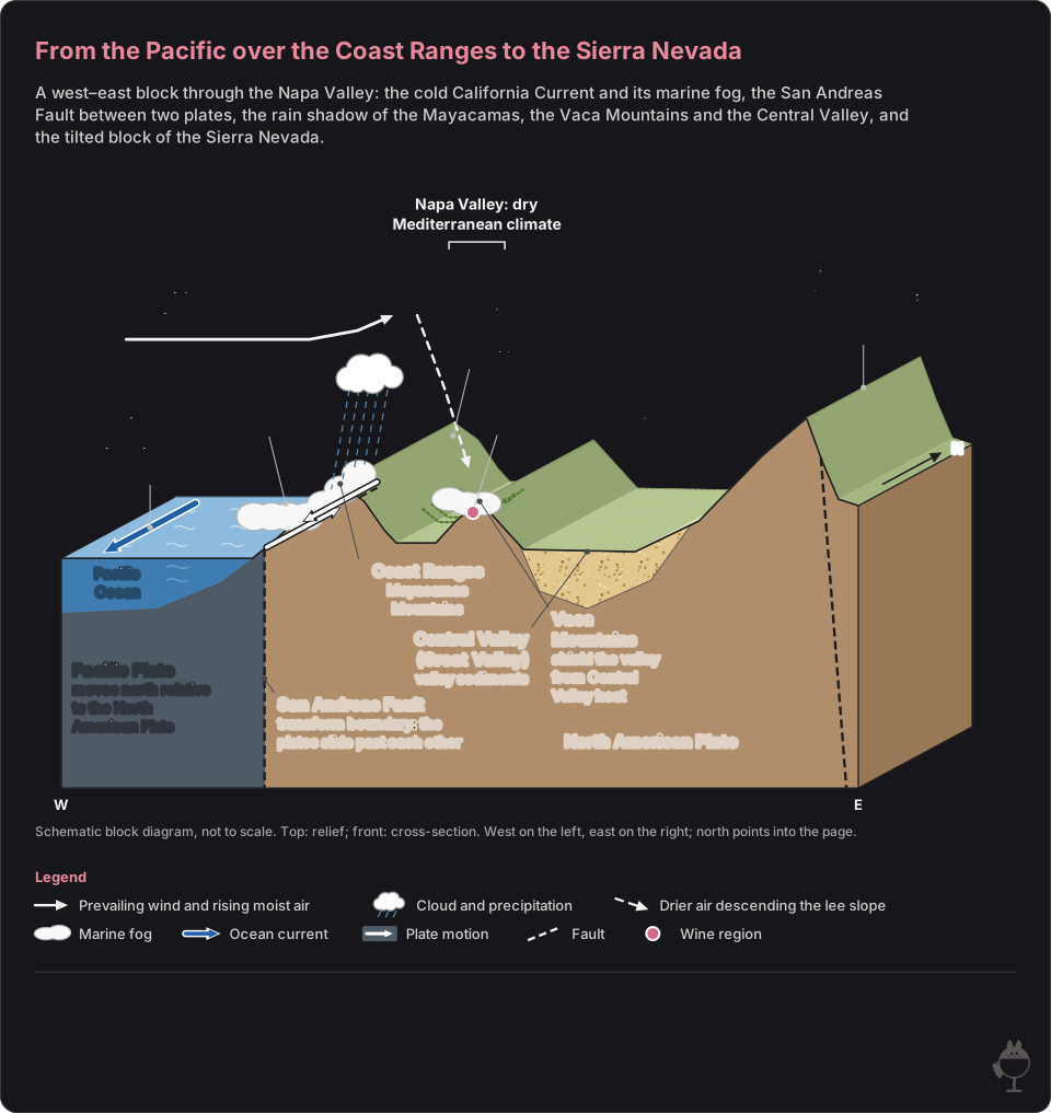
Schematic block diagram, not to scale: the top shows the relief and the front face a cross-section, coloured by soil and rock type.
Read the figure as text
- The San Andreas Fault is a transform boundary: the Pacific Plate, on its western side, moves north relative to the North American Plate, and the Coast Ranges run roughly parallel to the fault.
- The California Current is the cold current off the west coast of the United States; like other west-coast currents it flows toward the equator. Over the cold water a cool, moist marine layer forms.
- In summer, hot air rising over California’s interior draws cool, moist Pacific air inland, forming the marine fog that reaches the Napa Valley on most warm days.
- The Napa Valley lies between the Mayacamas Mountains, part of the northern Coast Ranges, to the west and the Vaca Mountains to the east. The Mayacamas act as a rain shadow that lessens the winter Pacific storms; the Vaca range shields the valley from the heat of the Central Valley.
- The Napa Valley has a dry Mediterranean climate.
- The Sierra Nevada is a tilted fault block: a high, rugged eastern face and a gentle western slope that disappears under the sediments of the Great Valley.
Climate: a dry Mediterranean valley, summer fog and a winter rain shadow
The valley's climate is dry Mediterranean, and each of the two ranges plays a part in it. The Mayacamas act as a rain shadow that weakens the Pacific storms of winter; a rain shadow is an area of reduced precipitation on the lee side of a mountain barrier, where the descending air warms and clouds dissipate. The Vaca Mountains shield the valley from the heat of the Central Valley.
Summer brings fog. Off the coast, the cold California Current flows south, toward the equator, and a cool, moist marine layer forms over the cold water. When hot air rises over California's interior, it draws that cool, moist Pacific air inland, and the marine fog reaches the Napa Valley on most days during the warmer months.
The figure below separates the two seasons: Pacific storms weakened by the Mayacamas in winter, and fog drawn in from the ocean in summer. It shows the order of causes, not their strength.
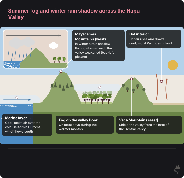
A west–east section in summer: the marine layer over the cold ocean, fog on the valley floor between the two ranges, and hot air rising over the interior. The small picture shows winter storms from the Pacific losing rain over the Mayacamas. The arrow over the ocean shows only that the air moves inland, not the fog’s route. Not to scale; shapes and colours are illustrative.
- The Vaca Mountains, on the east side of the valley, shield it from the heat of the Central Valley.
Read the figure as text
- Mayacamas Mountains (west) — In winter a rain shadow: Pacific storms reach the valley weakened (top-left picture)
- Hot interior — Hot air rises and draws cool, moist Pacific air inland
- Marine layer — Cool, moist air over the cold California Current, which flows south
- Fog on the valley floor — On most days during the warmer months
- Vaca Mountains (east) — Shield the valley from the heat of the Central Valley
Valley floor and slopes
Two questions matter most when the valley floor is compared with the mountain slopes: whether a hillside vineyard sits above the morning fog, and how its soils differ from those of the valley floor.
For elevation and soil, look to the official American Viticultural Area (AVA) definitions and to geological maps; for the height of the fog line, to local climate observations.
A geological map has to cover the vineyard in question. The U.S. Geological Survey, for example, has published a geologic map of the central Mayacmas Mountains (the survey's spelling) and The Geysers steam field; its title names Sonoma, Lake and Mendocino counties, not Napa County. Reading the rock beneath a specific Napa vineyard is a separate task from the regional picture given here.
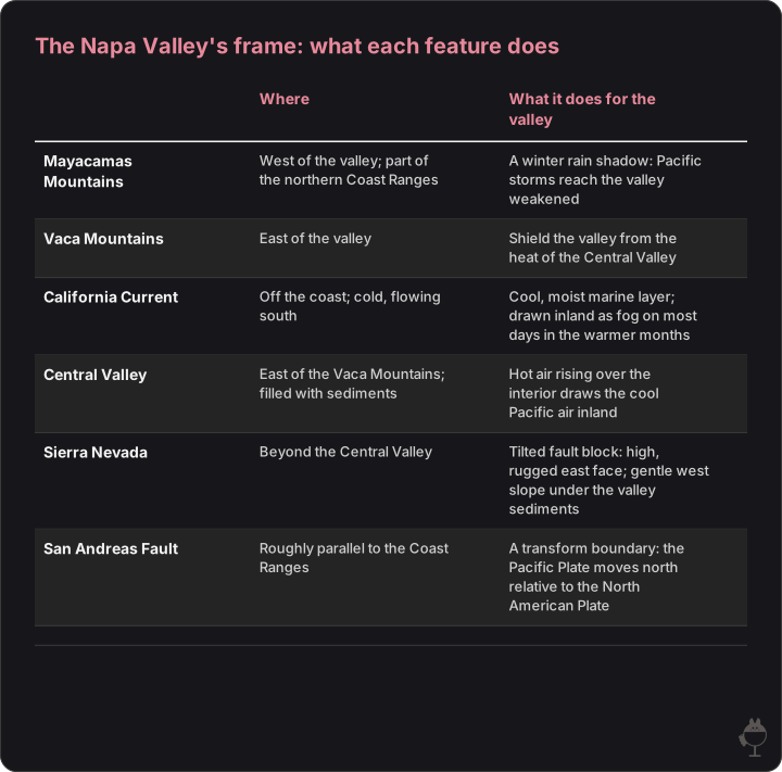
The features named in this article, from the Pacific to the Sierra Nevada, with the role each plays for the valley's climate or landform. Nothing here is a measurement.
Read the figure as text
| Where | What it does for the valley | |
|---|---|---|
| Mayacamas Mountains | West of the valley; part of the northern Coast Ranges | A winter rain shadow: Pacific storms reach the valley weakened |
| Vaca Mountains | East of the valley | Shield the valley from the heat of the Central Valley |
| California Current | Off the coast; cold, flowing south | Cool, moist marine layer; drawn inland as fog on most days in the warmer months |
| Central Valley | East of the Vaca Mountains; filled with sediments | Hot air rising over the interior draws the cool Pacific air inland |
| Sierra Nevada | Beyond the Central Valley | Tilted fault block: high, rugged east face; gentle west slope under the valley sediments |
| San Andreas Fault | Roughly parallel to the Coast Ranges | A transform boundary: the Pacific Plate moves north relative to the North American Plate |
Comparing the two in the glass
Treat any 'valley floor' or 'mountain' style as a hypothesis to test, not as a rule. A useful exercise is to taste two wines of the same grape and vintage, for example two Cabernet Sauvignons, one labelled as coming from a valley-floor site and the other from a hillside site.
Write down what you observe before reading the back label or any tasting note: intensity of colour, intensity and character of the aroma, acidity, the amount and texture of the tannin, alcohol and finish. Then compare the two descriptions. A difference may come from the site, but also from the grower's choices and the winemaking, so a single pair of wines cannot prove a site effect.
Written exercise 1: summer fog and the two ranges
Question
Explain how marine fog reaches the Napa Valley in summer. Then name the two ranges that frame the valley and the role each one plays in its climate.
Model answer
Off the coast, the cold California Current flows south and a cool, moist marine layer forms over it. In summer, hot air rising over California's interior draws this cool, moist air inland, and marine fog reaches the Napa Valley on most days during the warmer months. The Mayacamas Mountains on the west act as a rain shadow that weakens the Pacific storms of winter; the Vaca Mountains on the east shield the valley from the heat of the Central Valley.
Self-check (Maison's own rubric, not an official examination scheme)
• The cold California Current and the marine layer that forms over it
• Hot air over the interior drawing Pacific air inland in summer
• Fog on most days during the warmer months, not on every day
• The Mayacamas as a rain shadow in winter; the Vaca Mountains as a shield against the Central Valley's heat
Written exercise 2: checking a claim
Question
A wine list describes a Napa hillside wine as 'grown above the fog'. What would you need to know to check this claim, and why can a description of the whole valley not settle it on its own?
Model answer
You would need the elevation of the vineyard and the height that the marine fog reaches in that part of the valley during the growing season, preferably over several years. A regional description, like the one in this article, explains how the fog forms and how often it comes, but it does not show where a single vineyard sits relative to the fog. A topographic or geological map can give the vineyard's elevation and the rocks beneath it, but the claim about fog needs local climate observations.
Self-check (Maison's own rubric, not an official examination scheme)
• The vineyard's elevation is needed
• The height of the fog in that area and season is needed
• Explains why a description of the whole valley cannot settle the claim for one vineyard
• Separates location and geology (maps) from fog (climate observations)
Physical setting
- Cold California Current offshore; the Mayacamas to the west and the Vaca Mountains to the east
Climate response
- Marine fog on most days during the warmer months; winter storms weakened by the rain shadow; the Central Valley's heat held back
In the glass
- Compare a valley-floor wine and a hillside wine of the same grape and vintage before drawing conclusions
Frequently asked questions
Why does fog reach the Napa Valley in summer?
Hot air rising over California's interior draws cool, moist Pacific air inland. That air comes from the marine layer that forms over the cold California Current, and the resulting marine fog reaches the valley on most days during the warmer months.
What do the Mayacamas and Vaca Mountains do for the valley's climate?
The Mayacamas Mountains on the west act as a rain shadow that weakens winter storms from the Pacific. The Vaca Mountains on the east shield the valley from the heat of the Central Valley. Between them lies a valley with a dry Mediterranean climate.
Do Napa's mountain vineyards sit above the fog?
Whether a particular hillside vineyard sits above the fog depends on its elevation and on how high the fog reaches in that part of the valley during the growing season. Official AVA definitions and local climate observations are the places to look.
Sources
- Napa Valley Vintners: What makes Napa Valley ideal for growing wine grapes – climate, soils, terrain
- NOAA JetStream: The marine layer
- NOAA JetStream: Ocean circulations
- NOAA National Weather Service glossary: rain shadow
- U.S. Geological Survey, This Dynamic Earth: Understanding plate motions
- California Geological Survey, Note 36: California geomorphic provinces
- U.S. Geological Survey: GIS data for the geologic map of the central Mayacmas Mountains and The Geysers steam field, Sonoma, Lake, and Mendocino counties, California
- NOAA National Weather Service glossary: orographic